


Fort of Saint Anthony
Coordinates
Geographical: 37ş7'18'' N, 7ş37'17'' W
Decimal (GPS): 37.121638,-7.621502
Fort of Saint Anthony
Also known as Forte do Rato (fort of the mouse) and Forte da Ilha das Lebres (fort of the island of the hares), Forte de Santo António was built in the second half of the 16th century, at the entrance of the river Gilăo, with the purpose of defending the port of Tavira.
In the context of the War of Restoration (after 1640), it was remodelled to complement Fort of Săo Joăo da Barra, which was founded in 1672.
Featured
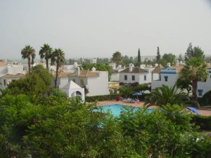 Quinta Velha Village
Cabanas, Tavira
$$$$ (100 to 150 euros)
Quinta Velha is a cosy resort located by the fishing village of Cabanas, with a huge swimming-pool with its bar, a high quality restaurant and a games room, in a green and calm environment.
Best deals